A – B – Ceee we were told it would be an Active 2020 Hurricane Season
By- Andrew Siffert - Vice President / Senior Meteorologist
Back in early May, I highlighted that trouble was brewing for the 2020 Atlantic Hurricane Season. In that BMS Insight, I outlined the climate forcers that pointed towards an active season which could result in one of the most important hurricane season for the insurance industry due to the ongoing COVID-19 pandemic. Since then, the third Tropical Storm of the 2020 Atlantic Hurricane Season has been named in the Southern Gulf of Mexico in the Bay of Campeche, which means we are already on the letter “C” - Cristobal. This is the earliest a third named storm has ever formed during hurricane season in the Atlantic Basin. Even in 2005, which was the most active season in terms of the number of storms, the third storm of the season did not form until July 5th. Furthermore, the long term average of the formation of the third named storm is typically around August 13th. However, there is a clear trend to naming storms earlier as the average date of the third storm of the year in the 2010s is July 13th. It should be noted that early-season named storms are not well correlated to increased overall named storm activity for the season, but having this many storms so early in the season is still an interesting historical note.
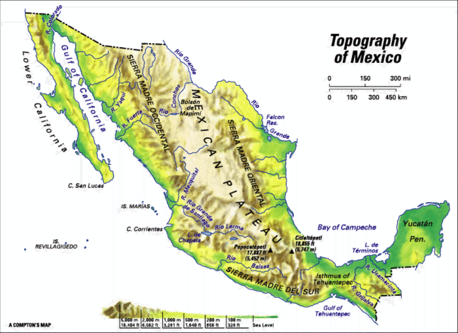
Bay of Campeche Likely Not An Issue
Overnight Cristobal continued to slowly meander and strengthen to a 60 mph Tropical Storm in the Bay of Campeche. What is important is the center of circulation continues to stay over the water right along the coastline; however, even if Cristobal tracks over the Yucatan, which it might do today, the area is generally flat and tropical and likely will not be as disruptive to the circulation if the storm stays to the east over the Yucatan. Nevertheless, what could be disruptive to the circulation of Cristobal would be its slow movement and the relatively shallow water in the Bay of Campeche which might cause some minor upwelling of cooler water and the storm could weaken slightly as very slow movement is expected until Saturday.
After Saturday the general forecast guidance is for Cristobal to move a bit more quickly into the central and northern Gulf of Mexico, which is the primary worry at this time because climatologically speaking tropical systems that are in the southern Gulf of Mexico generally undergo some strengthening. Hurricane Karl in 2010 was a good example of how fast hurricanes can develop in the area, and one of the strongest June hurricanes on record, Audrey (1957), strengthened into a category 3 also came out of the southern Gulf of Mexico and eventually made landfall in Louisiana.
U.S. Bound
It appears Cristobal will have an inevitable run-in with the United States with an impact to the insurance industry likely somewhere between Houston, TX and Mobile, AL, with the highest probability currently focused on Lake Charles, LA. At this time, the track seems to be fairly constant that Cristobal will move north with a landfall late Sunday or early Monday morning. The question that remains is: How strong will Cristobal be? The answer will determine the type of impacts we might expect from Cristobal’s landfall.
Strength Uncertainty
Currently, Cristobal could be either a tropical storm or a hurricane when it makes landfall along the U.S. Gulf Coast. Over the last few forecast model runs, of the very good ECMWF, not only has there been good agreement on a tropical system near Louisiana later this weekend or early next week, but several members have been suggesting a rare June hurricane at landfall over the last several days. Overnight the ECMWF model did back off from these chances, with fewer members of the ensemble suggesting central pressure would be below hurricane status at landfall. Yesterday the probability was close to 40% and today it is much lower at 20%.
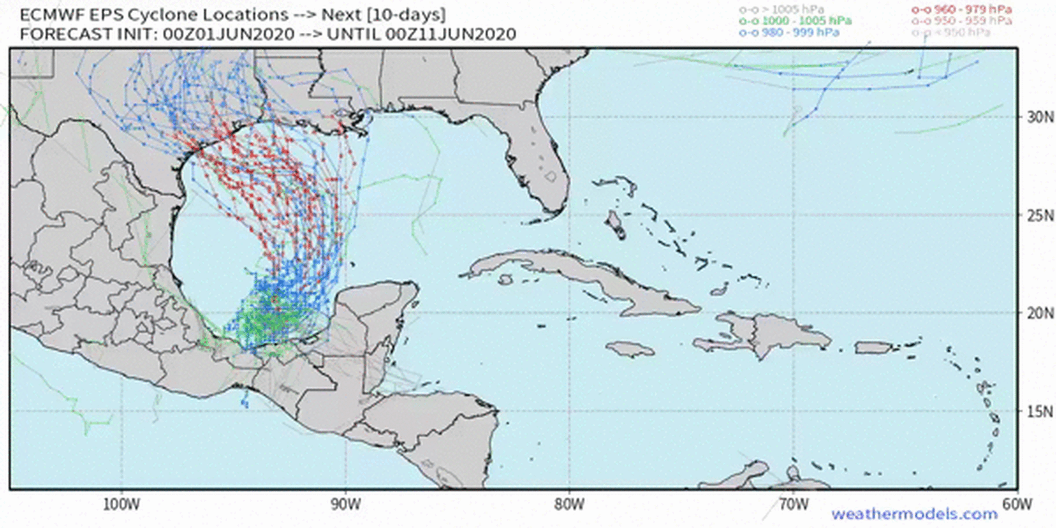
However, as I pointed out above, climatology would suggest some strengthening, and if Cristobal is already at 60 mph only 14 mph in strength is needed for a hurricane status and it would appear most forecast model guidance still suggests that Cristobal would be a type of tropical system that strengthens up until landfall. Therefore, there is a chance we will have our first Atlantic Hurricane of the 2020 season. And frankly, nothing in 2020 thus far seems normal, which is why I might be a bit more bullish with the intensity forecast at this time compared to the National Hurricane Center which calls for a strong Tropical Storm in the Northern Gulf of Mexico. At this time rapid intensification is not expected as Cristobal tracks northward due to slightly cooler sea surface temperatures.