By Andrew Siffert Vice President / Senior Meteorologist
As discussed in my July 23rd tropical update, a vigorous tropical wave was about to move off the west coast of Africa and looked ripe for tropical development. This tropical wave has now been dubbed Potential Tropical Cyclone (PTC) 9 by the National Hurricane Center (NHC). Its designation as a potential tropical cyclone means that the system has not yet met the relevant criteria to become a tropical cyclone, but is likely to do so in the future and will bring the impacts associated with a tropical cyclone to land areas. This allows for the issuance of tropical-cyclone-related watch/warning products before the system is officially deemed a tropical cyclone.
This large tropical wave has seen an increase in convection since yesterday, so there is an even better chance today that the NHC will upgrade the system to TD9 or even a named storm. If so, the storm will be named Isaias, which is likely one of the hardest names to pronounce in the 2020 storm list, so the first order of business is to provide guidance on how to officially say Isaias [ess-ah-EE-ahs]. This has replaced Ike after that name got retired in 2008. The list of storm names repeats every 6 years and each year the name is reused if it is not retired. In 2014 the last storm name of that year was Hanna so this is the first season that Isaias might be used.
With the development of PTC9, the focus is on where it will likely go in the future and how strong the system will be for the insurance industry. The forecast support around PTC9 over the last week as it moved off Africa has had a northward bias and this even shows up in the last few NHC official forecasts.
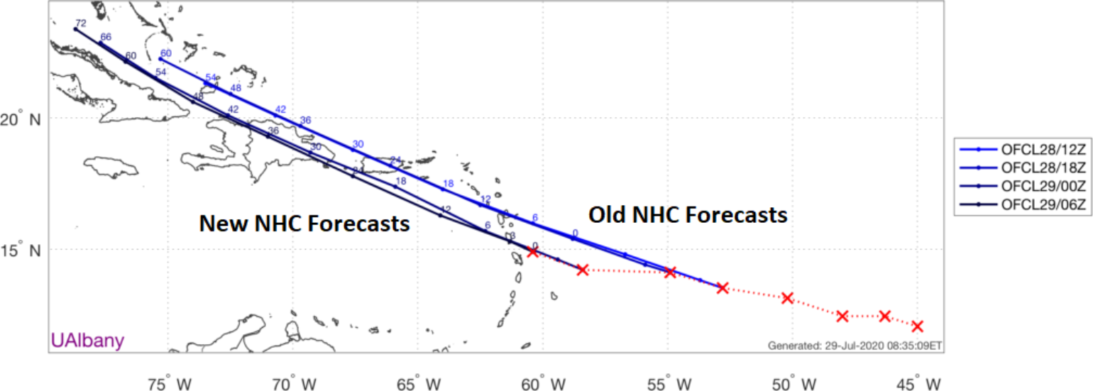
Because PTC9 has had this westward bias in movement versus a more northwest movement, most of the model guidance now has the overall disorganized circulation interacting with the higher topographical features of Puerto Rico and Hispaniola, which will complicate further intensification. This is good news for the insurance industry. However, the insurance industry is well aware of what happened last year when Dorain was able to shoot the gap between these two landmasses from the south and move into the warm water of the Bahamas. At the moment, PTC9’s anticipated interaction with the higher topography is critical to its future as the elevation interferes with the overall tropical waves circulation. This is why currently the forecast models keep PTC9 weak as it travels towards the U.S. If we do not see this interaction, there is no doubt the system could be much stronger in the future.
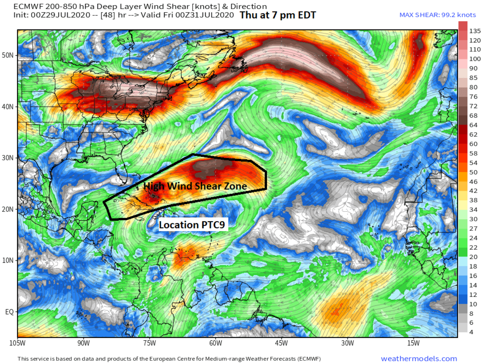
Now if PTC9 were to dodge the higher topographical land features in its forecasted track, the next hurdle it would face would be a wall of southwesterly wind shear that is forecasted to develop from Bermuda down to Cancun. If PTC 9 is relatively weak then it is likely to be shredded by this wind shear and will have a harder time developing into a stronger circulation towards the weekend. It is not to say that a remnant wave might redevelop later, but that is an unknown at this time. If PTC9 is a stronger storm in the coming days, it could potentially handle this shear zone a bit better. However, at this time there is little forecast support for a rapidly intensifying stronger system over the next 24 hours.
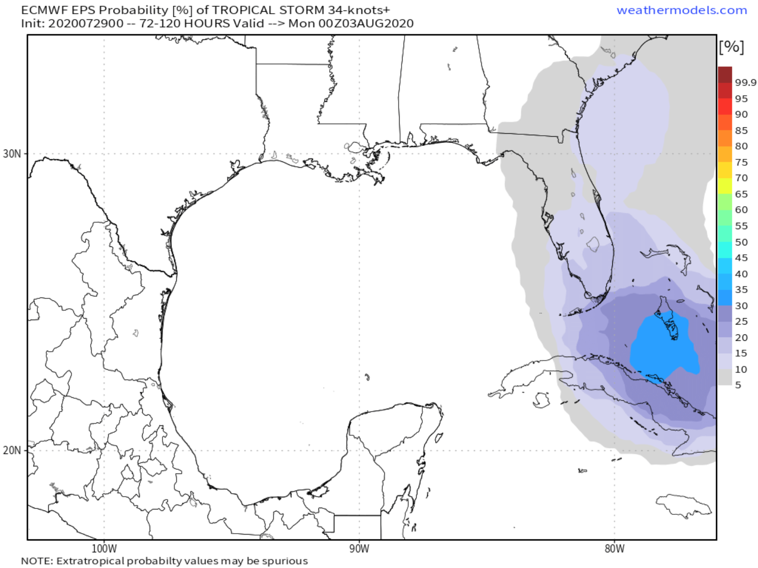
Regardless of how strong PTC 9 is over the next 24 – 36 hours, the synoptic pattern over eastern North America by the weekend will send the system north/northeast towards Florida or up the East Coast. This might be a tropical storm, with modest rain and wind at this time depending on the overall intensity, a disturbance with locally heavy rains, and nothing else, or it might be a stronger system with more impacts. Honestly, there is a lot of unknowns, but the forecast guidance is towards a weaker system and not a hurricane, but we also know from Dorian and Hanna that the forecast intensity of cyclones has poor skill at longer lead times. There should be an expectation for the forecast to change quickly on Friday as we see what happens to PTC9 over the next 48 hours.
In the last week, Hanna and Douglas have for the most part spared the insurance industry of large losses. These tropical systems have steered into a sparsely populated area of Texas and bypassed the Hawaii islands. So maybe there will also be luck steering PTC 9 into the higher topography and a weaker system being influenced by shear and be what the insurance industry needs to limit any more losses from a tropical system for July.
If PTC9 develops into something other than a tropical storm there will be more tropical updates, but at the moment there are no other tropical troubles to worry about in the next 10 days. However, we are now just starting to ramp up into what still looks to be a busy season.