It’s that time of year We have reached the time of year when the insurance industry starts paying attention to potential tropical troubles. In fact, over the last two weeks many media outlets have been focusing on possible development in the Gulf of Mexico. There was a weak area of disturbed weather that brought tropical rains to much of Florida last week, and now there is a new weather disturbance in the western Caribbean that is forecasted to move into the Gulf of Mexico for the upcoming Memorial Day weekend.
How common is a named storm in May?
In each of the last three years, the Atlantic Basin has seen some form of named storm development prior to May 24, so we are bucking the current trend with no named storm development yet in 2018. However, with the official start of the Atlantic hurricane season being June 1, it’s not too far-fetched to expect some type of named storm development by the end of May. In fact, 32 named storms have occurred during the month of May since 1851, with most of them forming in the western Atlantic or Caribbean and just a handful in the Gulf of Mexico. Of these 32 named storms, only 4 went on to become hurricanes, with no hurricanes actually making landfall in the U.S. during the month of May. The table from the NOAA Hurricane Research Division website counts the number of tropical storms and hurricanes, and it is clear that May storms are somewhat rare but not impossible.
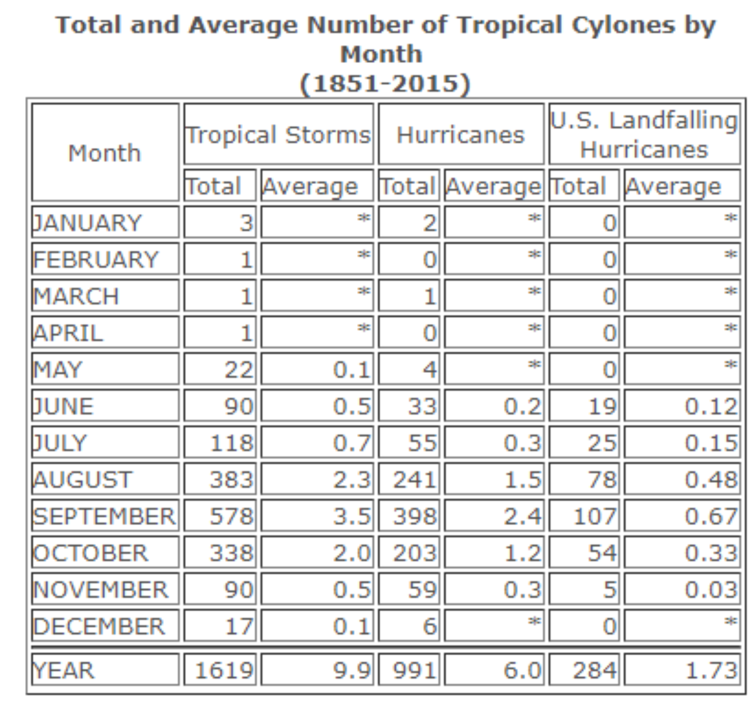
This table shows the total and average number of tropical storms, and those which became hurricanes, by month, for the period 1851-2015. It also shows the monthly total and average number of hurricanes to strike the U.S. since 1851.
Is Alberto brewing for Memorial Day weekend?
Alberto would be the first name of the Atlantic hurricane season if the current weather disturbance off the Yucatan Peninsula gets named. However, regardless of whether this particular system gets a name or not, the threat of heavy rainfall is significant. The latest NOAA Weather Prediction Center 5-day Quantitative Precipitation Forecast suggests another 3 to 5 inches of rainfall for Florida and parts of the southeastern United States. Some parts of Florida have already received up to 5 to 12 inches of rainfall over the period from May 13 to May 25, so the soil is already saturated over much of the area which could raise flooding concerns for the insurance industry.
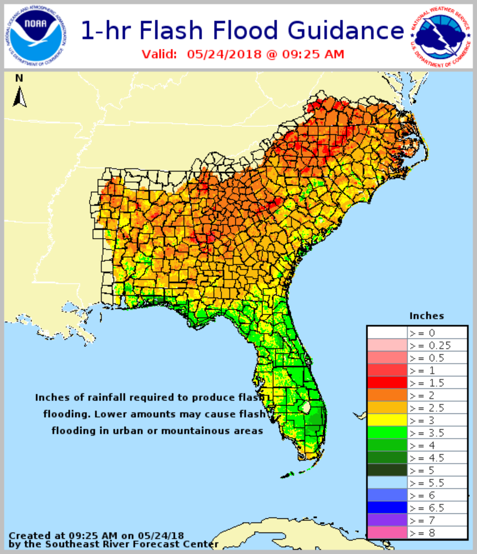
This product from the National Weather Service is the Flash Flood Guidance. This is an estimate of the amount of rainfall required over a given area in a given duration to cause flash flooding to small streams and rivers.
The current model war between the American (GFS) and the European (ECMWF) weather models currently disagree on how far west or east the disturbance will track as the system moves north into the Gulf of Mexico. The GFS model appears to be moving the system over the Florida Peninsula, with the ECMWF model sending it towards the central Gulf Coast and Louisiana. Based on the overall track record of the GFS, the model of choice at this point would be the ECMWF track because of what appears to be ongoing issues with the GFS model being too progressive with developing tropical systems and tracking them to the east. However, given the broad and disorganized nature of the system at this time, there is a fair amount of uncertainty in its eventual track, but given the NHC current probability of formation, a subtropical or tropical depression is likely to form by late Saturday over the southeastern Gulf of Mexico.
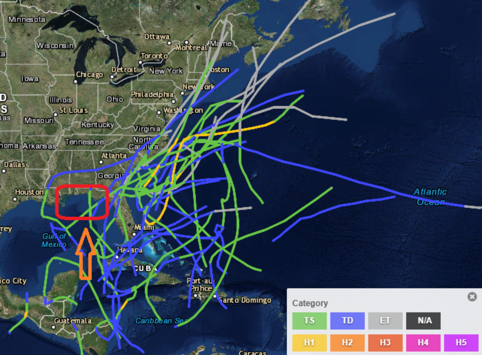
Shown above are the 32 Atlantic tropical cyclones during the month of May since 1851. Most have formed in the western Atlantic or Caribbean, with very few in the Gulf. Here I have outlined where Alberto will likely form this weekend and make landfall during the long weekend.
Over the busy 2017 Atlantic hurricane season, the landfall of hurricane Nate is often forgotten. Nate made landfall around the mouth of the Mississippi River, impacting the Southeast states and resulting in $108 million in insured loss. Very few model runs develop the current disturbance into a hurricane, so the insured impact should be well below any level of loss experienced from Nate last year. Based on the current forecast, gusty winds, large waves and very wet conditions should occur over much of the central Gulf Coast and Florida over the upcoming Memorial Day weekend.Regardless of whether this system develops into something more significant, the tropical troubles we’re now seeing are a sign that we’re approaching another hurricane season. However, don’t get too anxious due to an early season of tropical development. History has shown us that it tells us nothing about the season ahead. The 2017 season was close to the median of climatology until the end of August, when the season ended up going near the climatological maximum in terms of Accumulated Cyclone Energy (ACE).
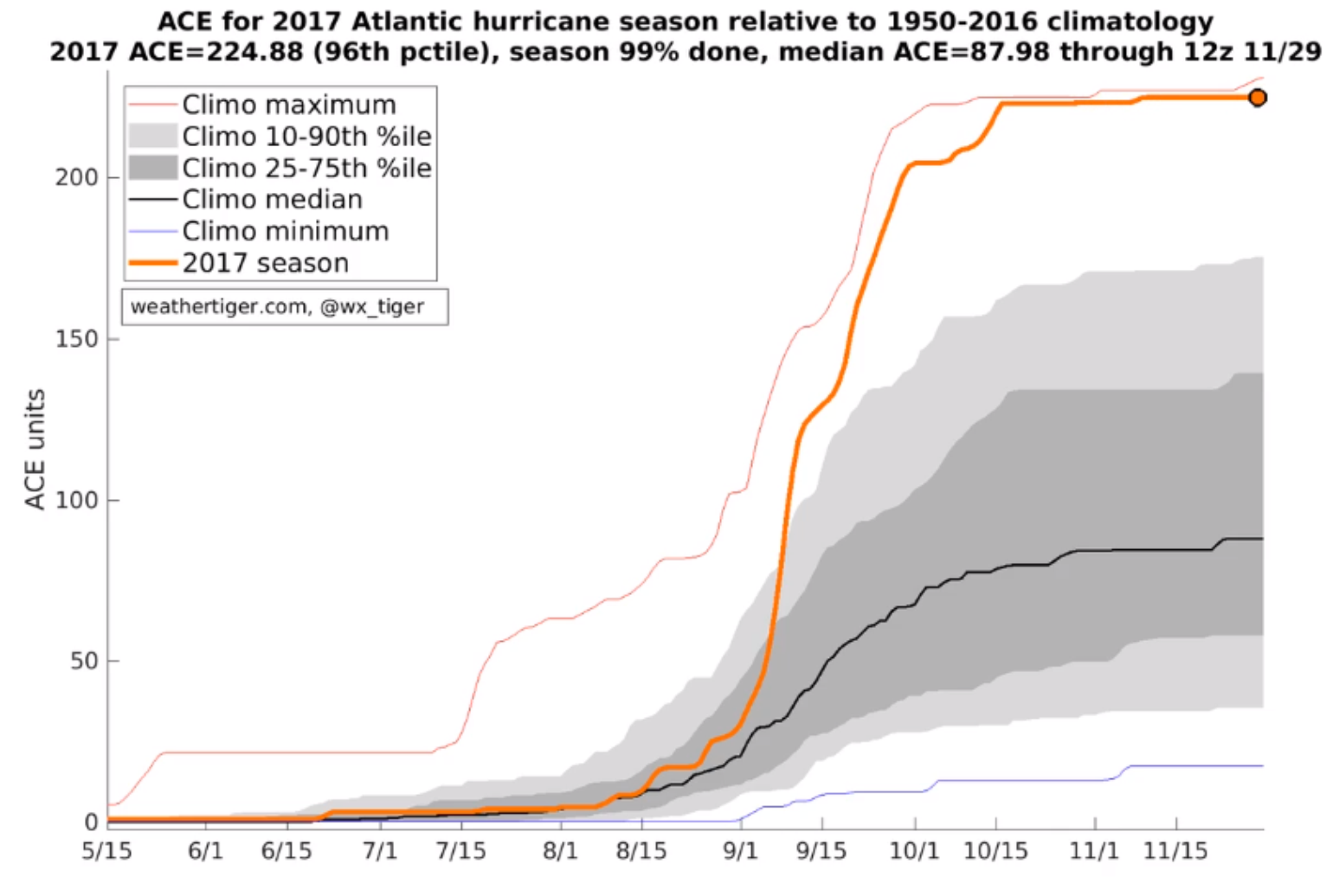
ACE as measured during 2017 vs climatology from @wx_Tiger. There is no correlation to early season activity and how the season will end up. 2017 is a great example of this.